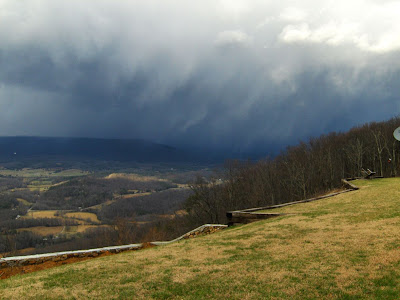
Wendy & I, as most of you know, drove for Google. We mapped an area that was(approx.) 150 miles RADIUS of Chattanooga, Tn. We mapped every road, country & interstate, that was open. Saying that, we didn't go into areas that was gated communities, or roads that said "No Trespassing". We also mapped more areas ~all the way to Memphis. Those were only major roads though.
I didn't know that anyone was interested in seeing them from out of state. However, when I read on the OZ report tonight that Craig Stanley had found it, and posted it, I thought I would take it another step because it was for a forum for "checking out other sites". So, below are the addresses for our site here at Lookout Mountain, Henson's, & Whitwell. Launch & LZ's.
Craig and David Glover posted some links to Henson's where the Team Challenge '07 was taking place. I had to work, so keeping in rhythm with Ollie's spirit, I brought the Google car over, and got the area on camera, during fly-days.
Lookout Mountain Flight Park------
7518 scenic Hwy, Lookout Mountain, Ga, United States is a look at Launch, on a fly day
1770 Creek rd, Valley, Ga, United States is the look at the LZ.
You can even "drive" around the cabins,and from both ends of the field. Spent some time trying to figure out how to do this without overlapping and loosing some of the footage, and when there was gliders being set up, flying, and being broken down.
Henson's Gap----
Below are the links to some of Henson's Gap site. Craig Stanley posted the links on the Oz Report, for everyone there.
http://maps.google.com/maps?f=q&hl=en&geocode=&q=window+rock+road,+dunlap+tn&sll=35.564599,-97.562521&sspn=0.009496,0.019312&g=2273+Downing+St,+Oklahoma+City,+OK+73120&ie=UTF8&layer=c&cbll=35.347881,-85.330408&panoid=spIWW_QccEO4uXnf63VKew&cbp=12,255.42420138871282,,0,13.280094827235027&ll=35.347756,-85.330467&spn=0.015332,0.132179&t=h&z=14&iwloc=addr
http://maps.google.com/maps?f=q&hl=en&geocode=&q=window+rock+road,+dunlap+tn&sll=35.564599,-97.562521&sspn=0.009496,0.019312&g=2273+Downing+St,+Oklahoma+City,+OK+73120&ie=UTF8&ll=35.348456,-85.332012&spn=0.038084,0.077248&z=14&layer=c&cbll=35.34852,-85.332069&panoid=28fS91XOGf4mPDd6lzb6jQ&cbp=12,128.92151956970875,,0,1.4497443114057098
Henson's primary LZ is 26.2 miles due south at Marion County Airport. Just kidding. Sorry, a little XC humor there.
442 Davis Loop, Dunlap, Tn, United States is the primary LZ look. Can you tell I love this site, and the people that fly here !
Whitwell---
You can't really see launch from the this pic, but you can see how to get to launch from here. I drove all the way to the set-up area trying to get all the gliders, however, the road officially stops in the bend, on this gravel road and they cut it out. Hey, I tried.
4048 Mt. olive Road, Whitwell, Tn , United States is how to get to launch.
Take the short road off of the main road, in between the houses/trailers.
1908 Main St., Whitwell, Tn. is to the Church LZ. Primary LZ.
I even went a little bit further with this one. You can literally drive down Both sides of the church, to the back side of the church and see the entire lz. Oh, and looks aren't deceiving. That's why it's a Hang 3 site, among other reasons.
13164 S. Pine St., Whitwell, Tn is a look at Castle's bailout LZ. I love this field. GREAT to land in!
You can pan the screens 360 degrees by left clicking mouse, and dragging the picture where you want it. The most important thing about using this to find stuff,,,,,,the addresses Suck. I haven't found Any that match what they are suppose to actually be. My personal address is off more than 500. The addresses on here are actual, not what they should be. If you area has been done by Google Street View/ City block,,,, and you know where you live and take a look at it,,,,promise you it will not match. You can also drive up and down the road by clicking the arrows in a certain direction.
If you have any questions, or comments, either email me(which is on here), or put a comment in the appropriate area.
Hope to see you all at one of our local sites!
If you would like to see the Team Challenge picture in better clarity,, click the below link and scroll down the Oct 8TH,'07 post.
http://ifly4funn.blogspot.com/2007_10_01_archive.html


